NH Department of Transportation deserves a lot of credit for developing the tool you are about to use. Thank you NHDOT!
This page contains instructions on how to use the NHDOT NH Roads Viewer. Please click this link to open the road viewer in a new window.
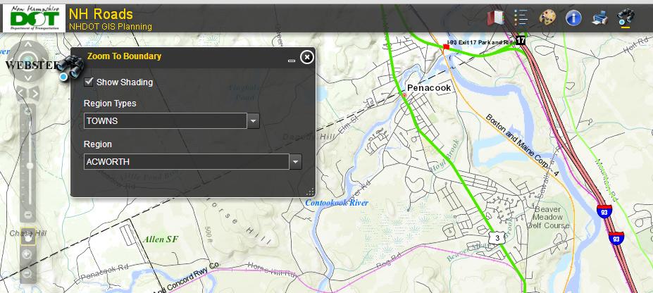
Once the app opens you see something similar to this. With the Region Type set to Towns you can select the town of interest from the Region drop down list.

NHDOT NH Road Ownership & Maintenance App.
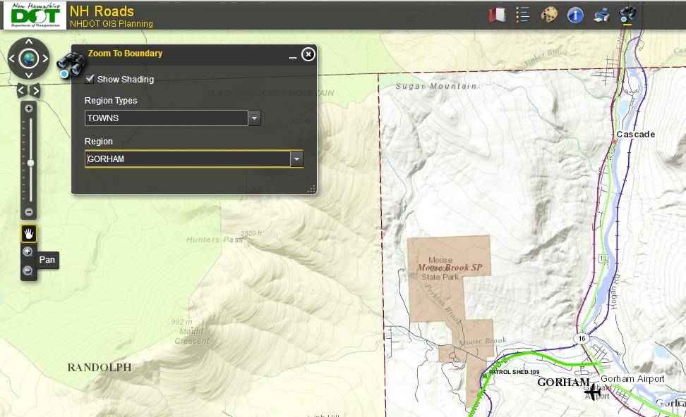
As soon a you select a town the app will display the full town boundary on the screen.

NH Roads App showing the Pan tool.
At this point you may need to Pan and Zoom using the tools near the left edge of the app to be able to see the street that interests you.
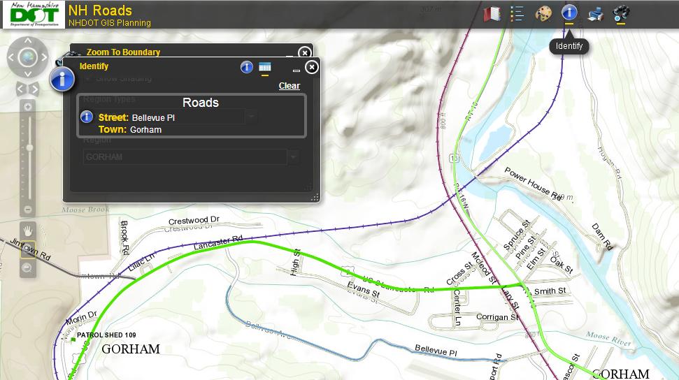
Pan is the hand tool. Zoom with + and -. Once you can see the street of interest its time to select the Identify tool. This tool is the Blue I icon at the top of the application. Use your mouse to click on it. Then use your mouse to click on the street of interest, in the example below Bellvue Place in Gorham was selected.

NH-Roads App zoomed in with Identify Tool active and a road selected.
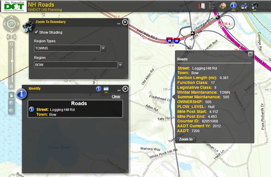
With the street selected its name appears in the Identify Window. When you position your mouse over the name of the street in that window the information you wanted appears. In the example Logging Hill Rd. in Bow, NH was selected to show a case where the ownership of the road is the State of NH as indicated by the 3 digit number 505. The first digit is the NHDOT Maintenance District (there are 6 of these in NH) the next two digits identify the specific maintenance shed that maintains the road. Additionally you can see the state maintains the road in the summer but the town does the plowing in the winter. The AADT shows the average daily number of vehicles on the road and the year that traffic information was last gathered.

NH-Roads App with Identify tool active, road selected, and detailed information displayed.
Now you know who maintains the roads. For more on NHDOT Maintenance See:
NHDOT Maintenance


